Soil Carbon Accrual Mapping with H3
Jun 2025
Grassroots Carbon
The problem
Grassroots Carbon works with ranchers to build soil organic carbon (SOC) through better grazing management. Model output is only useful if ranchers and project teams can see where on a property the potential is highest.
Approach
- Took per-location outputs from the SNAPGRAZE model of SOC accrual potential.
- Indexed them onto Uber's H3 hexagonal grid. Equal-area hexagons make neighboring cells directly comparable and aggregate cleanly across resolutions.
- Masked excluded areas inside the ranch boundary and rendered the result in Python with matplotlib, using a diverging color scale so low- and high-potential areas read at a glance.
Result
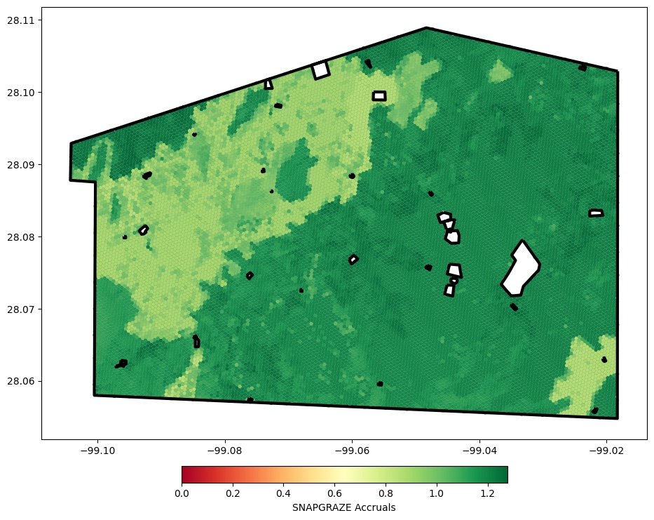
SNAPGRAZE accrual potential on a ranch in Texas, on H3 hexagons. Outlined areas are excluded from the project. Built in Python with matplotlib.