Forecasting Red Spruce Restoration
Aug 2019
NASA DEVELOP National Program, Summer 2019 · team project with M. Bull, T. Francis, K. Weber, J. Spruce, and C. Jarnevich
The problem
Two centuries of logging and mining in the Monongahela National Forest, in the Allegheny Highlands of West Virginia, dramatically altered its forests. The USFS wanted to restore red spruce and needed to know where it stands today, how it has changed, and where restoration would work best.
Approach
- Combined Landsat 5 TM, Landsat 8 OLI, and SRTM elevation data, and collected training data for classification.
- Mapped red spruce stands for four dates from 1989 to 2018 with a classification tree algorithm.
- Scored habitat suitability for the Sharp's Knob Red Spruce Restoration Area with fuzzy logic, identifying non-native stands where red spruce would thrive.
- Used the 2018 classification in the TerrSet Land Change Modeler to forecast red spruce extent to 2040.
My work spanned the literature review, training-data collection, running the classification models, the site suitability analysis, and producing the final maps to NASA's style guidelines, using ArcGIS, ENVI, TerrSet, and Google Earth Engine.
Results
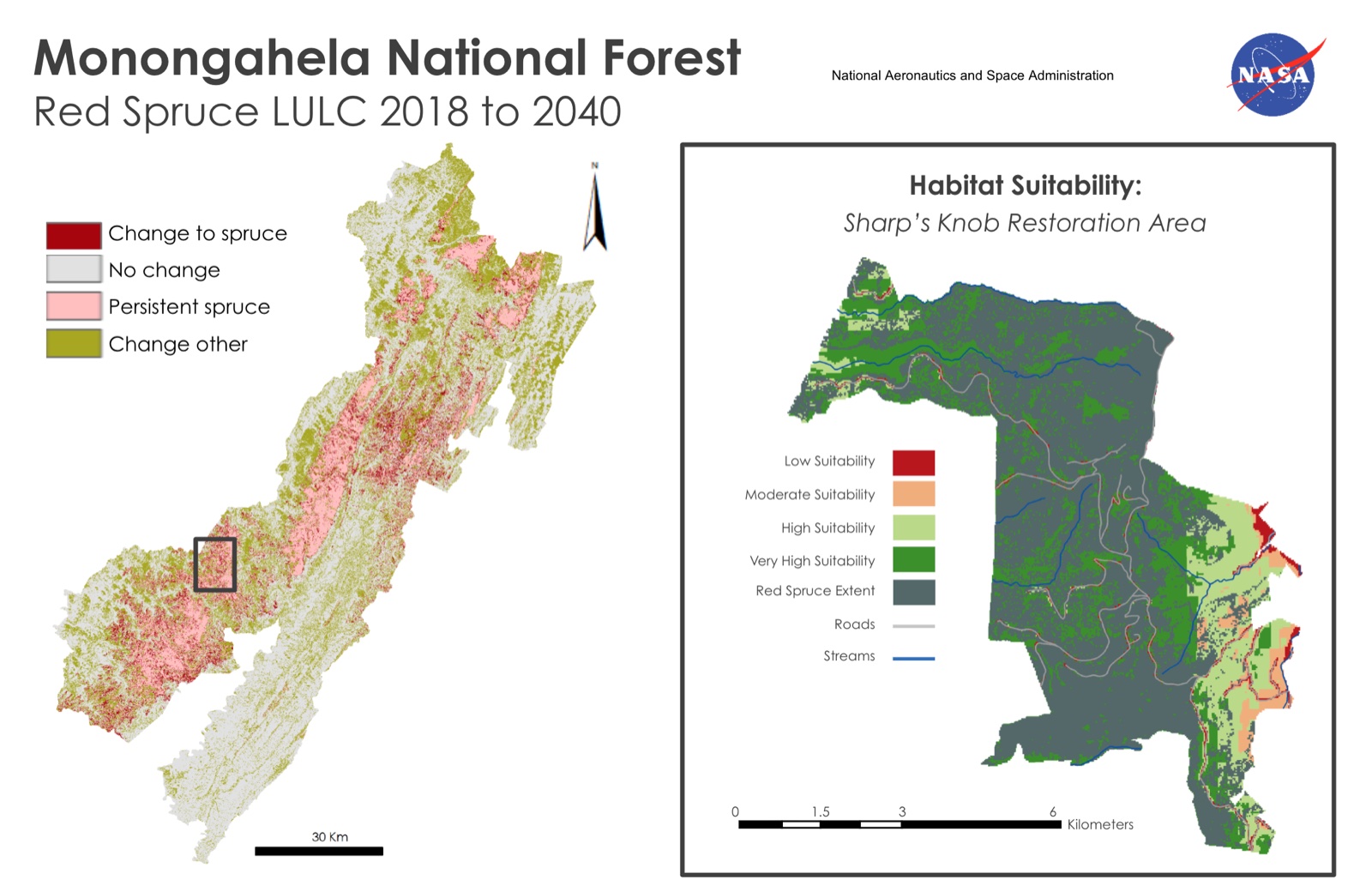
Left: forecast land-cover change, 2018 to 2040, from the classification tree and TerrSet Land Change Modeler. Right: habitat suitability for Sharp's Knob, built in ArcMap.
- 562 hectares of Sharp's Knob are suitable for future restoration.
- Red spruce stands grew 8% from 1989 to 2018.
- The forecast indicates the gains won't continue without management intervention.