Precision Viticulture Sampling
Dec 2020
E. & J. Gallo Winery · Viticulture Research GIS Intern · June–December 2020
The problem
Grape quality varies across a vineyard block, and field sampling is expensive. Gallo's viticulture research team wanted to know where to sample, and how satellite imagery could guide that, to make better irrigation decisions for yield and quality.
Approach
- Managed large field and imagery datasets, and automated satellite data acquisition.
- Kriging-interpolated Brix (grape sugar content) across a vineyard block for the 2017, 2018, and 2019 seasons.
- Compared sampling algorithm solutions driven by Landsat and Sentinel imagery against the measured block averages.
- Worked with cross-functional teams to turn the results into irrigation strategy.
Results
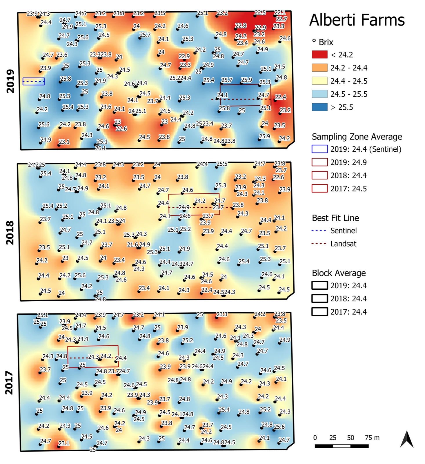
Kriging-interpolated Brix for 2017–2019 across a single block, with the sampling zones chosen from Landsat and Sentinel imagery. The block averaged 24.4 °Brix each year, and the satellite-driven sampling zones came within 0.5 °Brix of it. Built in QGIS.
Also
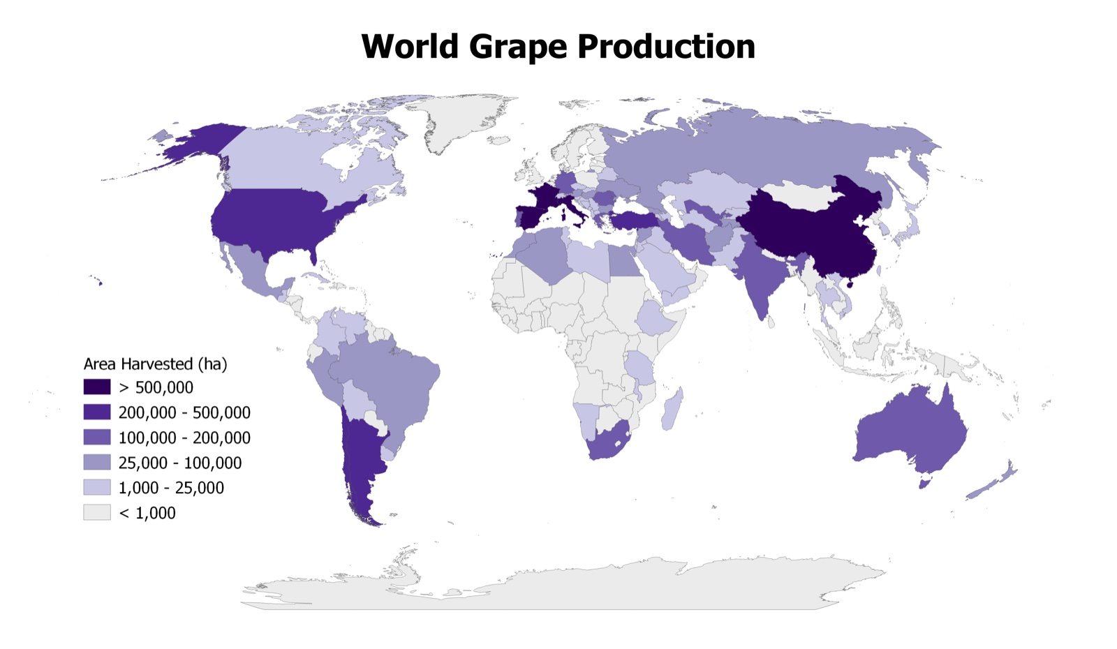
World grape production by country (area harvested, hectares), produced in QGIS from request to delivery within one business day.